This whole jet stream obsession started cause I kept totally screwing up my flight time estimates. Realized the stupid apps weren’t telling me squat about where that fast air was actually cruising. Needed my own data.

My first try was kinda lazy honestly
Grabbed some free weather app – looked nice, promised fancy wind arrows. Thought “easy peasy”. Plotted a route based on it, planned a trip day. Flight ended up slower than molasses in January. Why? That app showed winds everywhere, like, uselessly broad. It basically pointed and mumbled “wind fast up there somewhere maybe”. Ugh. Total garbage for actual planning.
Time to get my hands dirty
Figured I needed something hitting that specific sweet spot where planes fly high. Did some digging online (lots of coffee involved). Found a few sites offering upper air charts – sounded perfect! They showed data like:
- Wind Speed & Direction: Crucial stuff, obviously.
- Temperature: Found out this affects how bumpy the ride might be – neat!
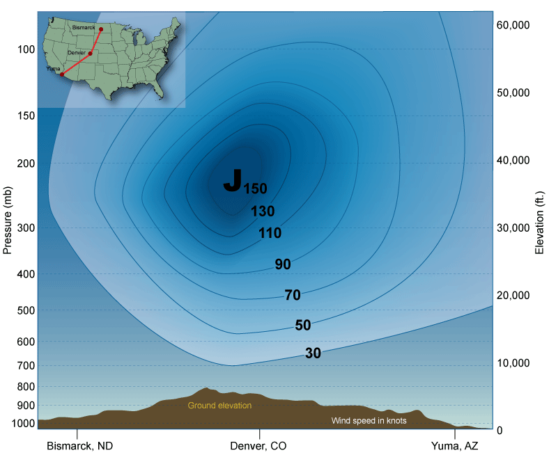
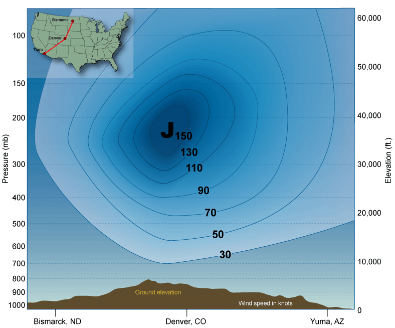
- Pressure Levels: This one confused me at first. Charts kept talking about pressure levels like 300mb, 250mb… Turns out, lower number = higher up! Kinda backwards, but okay. Jet stream usually hangs around the 250mb to 300mb spots way up high.
Started tracking these charts daily for my region. Found I could actually see that river of fast air winding around the map at like 35,000 feet. Made WAY more sense than that dumb app.
Double-checking my work like a nervous student
Okay, cool, I see the stream on the charts. But is it real? Needed proof! Had a slightly bonkers “genius” idea: launch some weather balloons? Yeah, no. That sounded complicated and bloody expensive.
Simpler fix: checked real-time wind reports from planes actually flying up there. Used some flight tracking info tools. When a plane heading east over Kansas reported a massive 150 knot tailwind… guess what? My fancy 250mb chart showed the jet stream smack dab over Kansas! Boom. Data matched up. Felt pretty smart.

Putting it all together (finally)
- Check the High Stuff: Learned to ignore ground-level forecasts for travel. Head straight to those upper air charts at 250mb/300mb.
- Find that River: Look for the thick lines showing the fastest winds winding across the map up at cruising altitude.
- Tailwind = Friend: Plane surfing with that fast current? Shaves serious hours off. Going against it? Might as well pack extra snacks and patience.
Honestly? It feels kinda obvious now, like “duh, of course you check winds where the plane flies”. But nobody seems to explain it clearly, just throws vague “windy” icons at you. Paying attention to that specific highway in the sky up around 30,000+ feet was the game changer for my travel guesses. Saved my butt from another slow-motion flight nightmare. I ain’t no scientist, but this works for me. Anyway, hope it helps someone else avoid my initial screwups!
