So, I got into this whole drone hobby a while back. It was pretty cool, unboxing my first one, feeling like a kid with a new toy. I mostly thought GPS, you know, was just for telling the drone where it was on a map – latitude, longitude, that kind of stuff. So it wouldn’t just fly off to who-knows-where.

My First Puzzling Moment
Then I was looking at the controller screen one day, and I saw this “altitude” reading. And I was like, “Hold on a minute, does GPS actually tell you how high up you are too?” I genuinely didn’t know. I always figured height was something you just kinda eyeballed or the drone had some other magic sensor for.
My first few flights, I was trying to be all precise. “Okay, fly at exactly 10 meters,” I’d tell myself. And I’d watch that altitude number. Sometimes it seemed spot on, other times, man, it felt like it was just guessing! The drone would be visually at the same height, but the number would be dancing around a bit. It was a bit frustrating, to be honest. I thought, “Is this GPS altitude thing even reliable?”
Digging In (Casually)
So, I started to just, you know, pay more attention. I wasn’t doing any hardcore scientific research, just messing around in my backyard and the local park. I’d fly the drone up, let it hover, and watch that altitude reading. Then I’d bring it down to near the ground and see what it said.
- I noticed that yeah, the GPS was definitely trying to give an altitude. The number changed when I went up or down.
- But, it often seemed less stable or accurate than the left-right, forward-back positioning. That part was usually rock solid.
This whole drone adventure, by the way, started because I messed up my knee pretty bad trying to learn skateboarding – don’t ask, mid-life crisis thing, I guess. Anyway, I was stuck at home for weeks, bored out of my skull. My buddy suggested getting a drone to keep me occupied, something I could do sitting down mostly. He said, “You like gadgets, you’ll love it!” He was right, but also, he never mentioned how tricky understanding all the little details like GPS altitude could be. I almost gave up after a near-miss with a tree, which I partly blamed on thinking the altitude reading was more gospel than it was. Turns out, my piloting skills also needed some serious work, haha!
The “Aha!” Moment
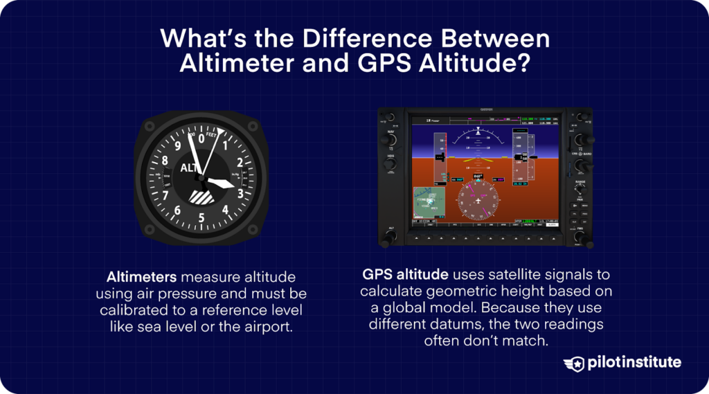
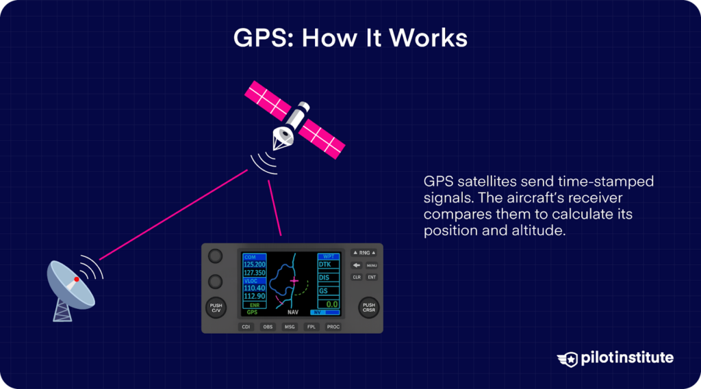
After a bit more fiddling and just observing, it kinda clicked. GPS does include altitude. It’s figuring out your position in three dimensions, not just two. So X, Y, and Z – or latitude, longitude, and yup, altitude.
But here’s the kicker I learned through my tinkering: getting that “up-down” part, the altitude, is just inherently trickier for the GPS. Think about it: to get your flat position, it needs to hear signals from a few of those satellite thingies up in the sky. To get your height accurately as well, it needs to see even more of them, and the angles and signals have to be just right. If there are buildings around, or trees, or even a cloudy day, it can make that vertical calculation a bit fuzzy.
What I Figured Out Works
So, while my drone’s GPS definitely gives an altitude, I realized it’s often a bit… approximate. For just general flying around, knowing if you’re roughly 20 feet or 100 feet up, it’s usually good enough. But if you need super-duper precision, like, down to the inch, GPS altitude alone might not be your best friend.
Later on, I found out that a lot of devices, including better drones and even my smartphone, sometimes mix that GPS altitude with other stuff. My drone, for example, has this tiny little sensor that measures air pressure – a barometric altimeter. That helps it smooth out the altitude readings and make them more stable, especially for holding a specific height. So it’s not always just GPS doing the altitude work.
So, Does It or Doesn’t It?
Yeah, long story short, GPS definitely includes altitude. It’s part of the whole 3D positioning deal. But from my own playing around, I’d say the altitude it gives you is often more of a good estimate than a pinpoint measurement, especially on consumer gadgets. It’s super useful, don’t get me wrong, but it’s good to know its limits. For my drone flying, understanding this made a big difference in not expecting too much from that one number on the screen.