My Go at Tracking a High Altitude Balloon on Flightradar24
Alright, let me tell you about this thing I tried recently. I spend a fair bit of time looking at Flightradar24, you know, checking out where planes are going. Mostly commercial flights, sometimes military stuff if it shows up. But then I heard folks talking about seeing high-altitude balloons on there. Sounded kinda neat, different from the usual jets whizzing about.

So, I thought, okay, let’s see if I can actually spot one myself. Wasn’t really sure where to start. I figured these balloons must have some sort of tracker on them that talks to the same system planes use, ADS-B I think it’s called? Otherwise, how would they even show up on the map? Makes sense. They float way up there, need to let planes know they exist, probably.
First thing I did was just open up Flightradar24 on my computer, like I usually do. I started scanning around, just zooming out and looking for icons that didn’t look like typical planes. Most balloons, I read somewhere, don’t use the standard plane icon. Sometimes it’s a balloon shape, sometimes just a generic dot or square.
Finding the darn thing wasn’t immediate, I’ll tell you that. The map can get pretty crowded. I tried a few things:
- Zooming way out over large land areas, thinking they might drift over less populated places.
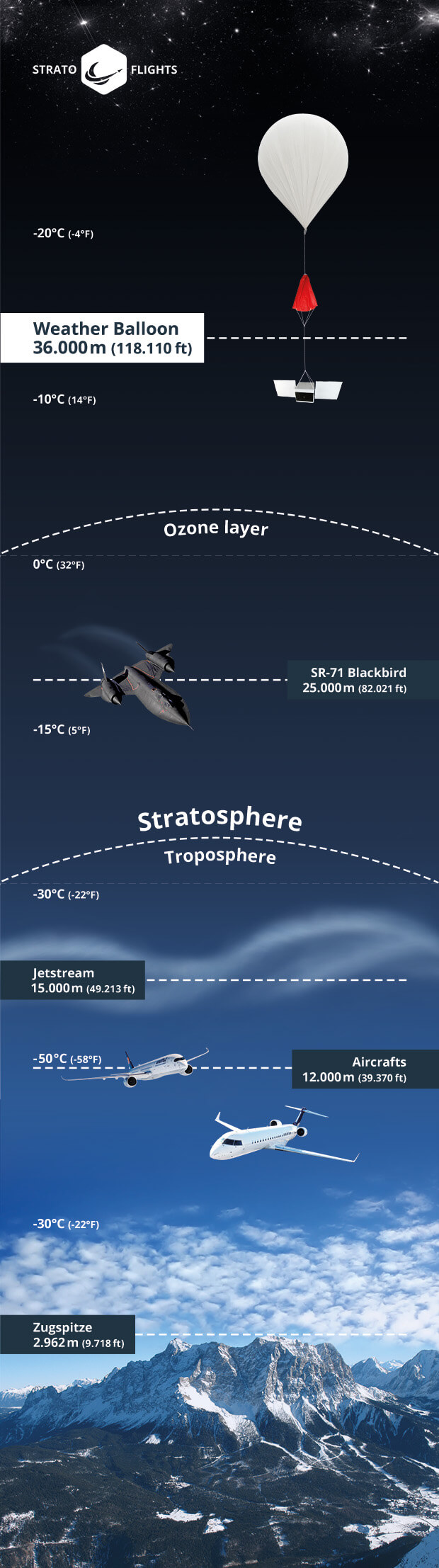
- Looking for things flying really high. Like, ridiculously high. We’re talking 60,000 feet, 80,000 feet, sometimes even higher. Way above where regular planes fly.
- Using the filters. This turned out to be the most useful trick. I went into the filter settings. I tried filtering by altitude, setting the minimum really high, like maybe 50,000 feet. That cleared out almost all the normal air traffic.
- Sometimes people share callsigns for known balloon projects online, stuff like ‘HBAL’ followed by numbers. If I knew one, I could search for that specific callsign. Didn’t have one handy this time, so I stuck to altitude filtering.
After playing with the filters for a bit, bingo! Found one. It was just a little dot, moving super slowly compared to the jets. Clicked on it, and sure enough, the details popped up. Altitude was way up there, like 75,000 feet. Speed was maybe 20 knots, just drifting with the wind. The callsign looked generic, didn’t tell me much about who launched it, might have been a weather balloon or some research thing.
It was pretty cool just watching it crawl across the map. Completely different pace from everything else. You could see its track history, where it had come from. I left the tab open for a while, checked back every now and then. Saw the altitude change a bit, watched it drift steadily eastward. No sudden turns or climbs like a plane, just floating along.
Eventually, I lost it. Maybe the tracker stopped, maybe it went out of range, or maybe it just came down. But seeing it up there, sharing the same map space as huge airliners, was quite something. It’s amazing what you can spot on these tracking sites if you just poke around a bit and try different ways of looking.
So yeah, that was my little experiment. Didn’t launch anything myself, just did some digital spotting. Pretty simple once I figured out the filtering trick. Worth a try if you’re curious about what else is floating around way up high.